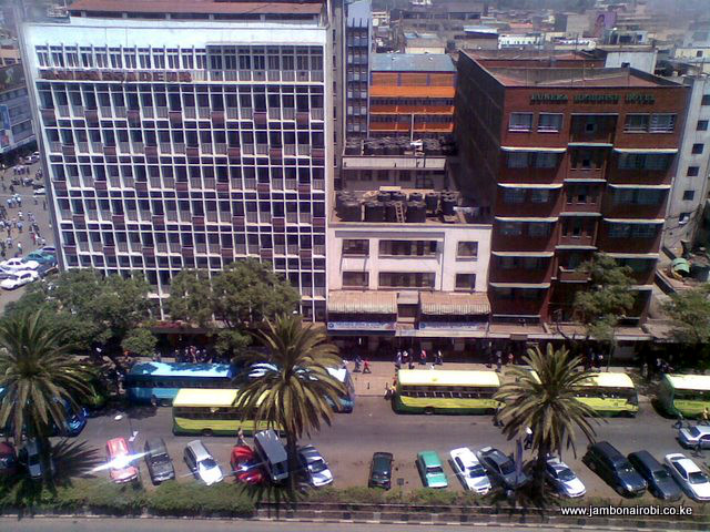
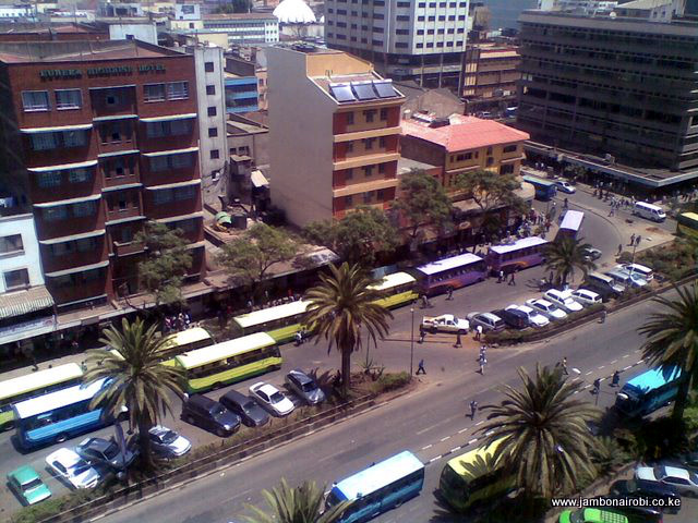
Ambassadeur Bus Stage
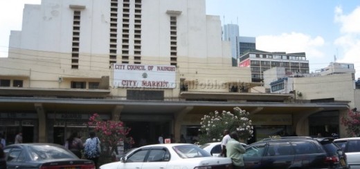
The Ambassadeur Bus Stage, situated on Moi Avenue outside Ambassadeur Hotel and adjacent to Kenya National Archives, is the city centre terminus for some of the buses heading to the eastern suburbs of Nairobi. This particular stage is normally crowded with people throughout the day, which can be discouraging. However, passenger embarkation and disembarkation at this bus stage is generally orderly, with most passengers queuing for the buses.
-

- Near Kenya National Archives

-
- Ambassadeur Bus Stage
-
- Ambassadeur Bus Stage
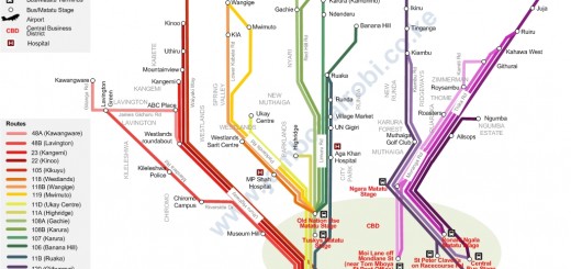
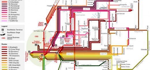
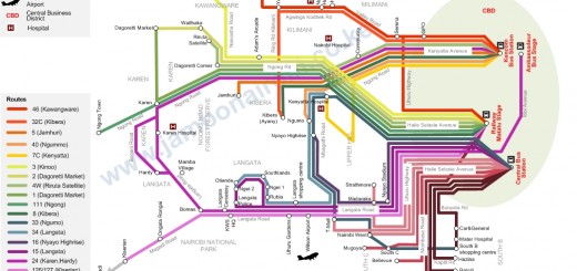
 You can get to the destinations indicated in the table below from this stage. You can also get to these destinations using matatus from the Muthurwa Bus Station and Accra Rd Matatu Stage. The route map to the left shows these routes graphically.
| Route | Destination | Route Description |
|---|---|---|
| 19/60 | Komarock | Jogoo Road, Donholm roundabout, Outer Ring Rd, Donholm, Savannah, Jacaranda, Kayole, Komarock |
| 24 | Karen | Haile Selassie Avenue, Uhuru Highway, Nyayo Stadium Roundabout, Langata Road, Madaraka, Bomas of Kenya, Langata South Road, Hardy, Bogani Road, Karen Blixen Museum, Karen Road, Karen Country Club, Langata Road, Karen Shopping Centre |
| 32 | Dandora | Kariokor, Juja Rd, Eastleigh, Mathare, Huruma, Kariobangi, Dandora |
| 33 (Utawala) | Utawala | Haile Selassie Avenue, Uhuru Highway, Mombasa Road, City Cabanas, North Airport Road, KQ Pride Centre, Administration Police (AP) Training School, Utawala |
| 33 (Nyayo) | Nyayo Estate | Haile Selassie Avenue, Uhuru Highway Mombasa Road, City Cabanas, North Airport Road, CocaCola bottling plant, Nyayo Estate |
| 34 | JKIA | Landhies Road, Jogoo Road, Donholm roundabout, Outer Ring Road, Tassia, Avenue Park, Fedha, Pipeline, JKIA |
| 58 | Buruburu | Landhies Road, Jogoo Road, Makadara, Rabai Road, Mumias South Road, Buruburu Phase 1 |


Is there a bus service from msa to nbo jkia.? Plz call me at 10 am 0795114356
Thkx