Mt Kenya, Chogoria Route
Updated 12 December 2016
Summary| Distance from Nairobi | About 210km |
| Starting Point | Chogoria Park Gate |
| Ending point | Point Lenana |
| Walking Duration | 4 - 5 days |
| Terrain | Dirt road to Road Head, followed by a narrow trail through the alpine zone to Mintos Hut, then rocky steep climb with loose gravel in some sections before reaching the summit. |
| Difficulty | Moderate to High. You need to be reasonably fit to do this hike. |
Mt Kenya is the ultimate hiking and climbing destination in Kenya. It is the highest mountain in Kenya and the second highest in Africa at 5199m above sea level (asl), and features ice-capped peaks, outlandish glacial valleys, an array of crystal-clear glacial lakes (Tarns), and a myriad of other attractions.
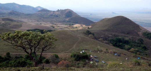
Out of the three popular routes for climbing Mt Kenya, Chogoria Route is without question the most scenic and rewarding for hikers interested in seeing beautiful landscapes and the exotic flora on Mt Kenya. The Chogoria route is on the east side of the mountain while Naro Moru and Sirimon routes are on the west and north sides of the mountain respectively.
-

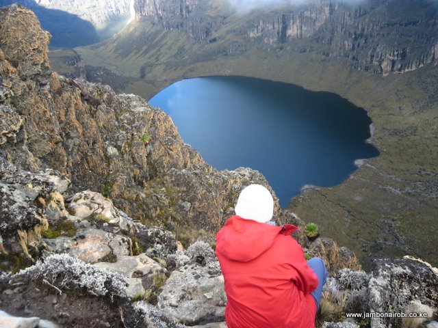
- Lake Michaelson, Mt Kenya
-
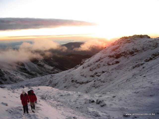
- Sunrise while summitting
-
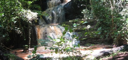
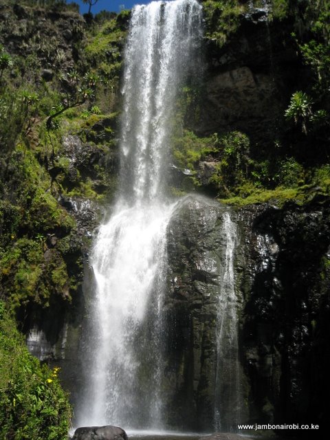
- Nithi Waterfalls, Mt Kenya
-
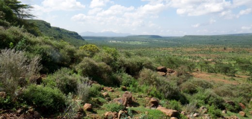
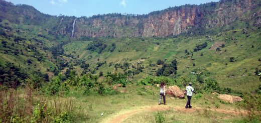
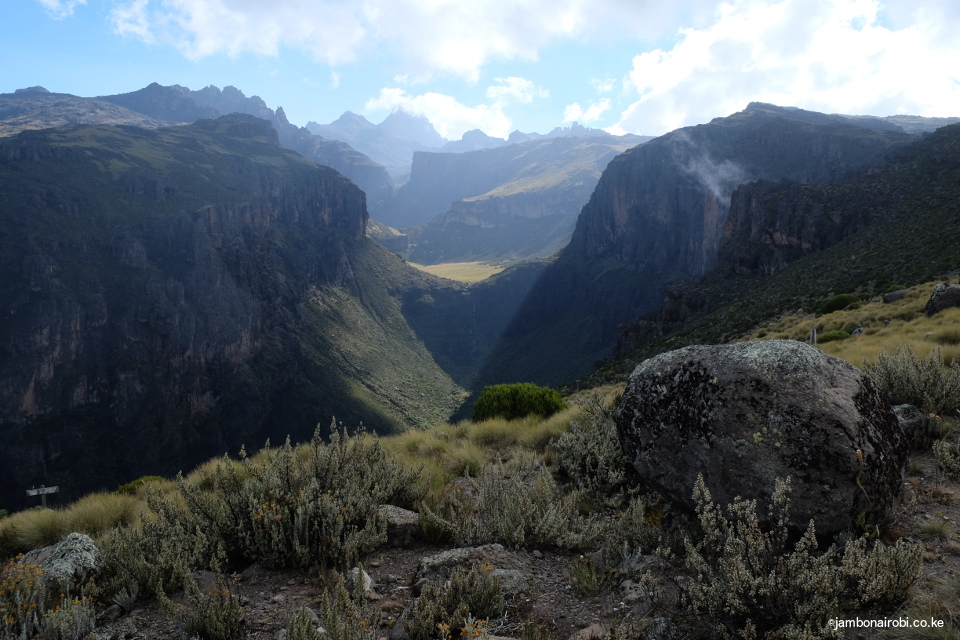
- Gorges Valley on Mt Kenya
-
- Rocky landscape

-
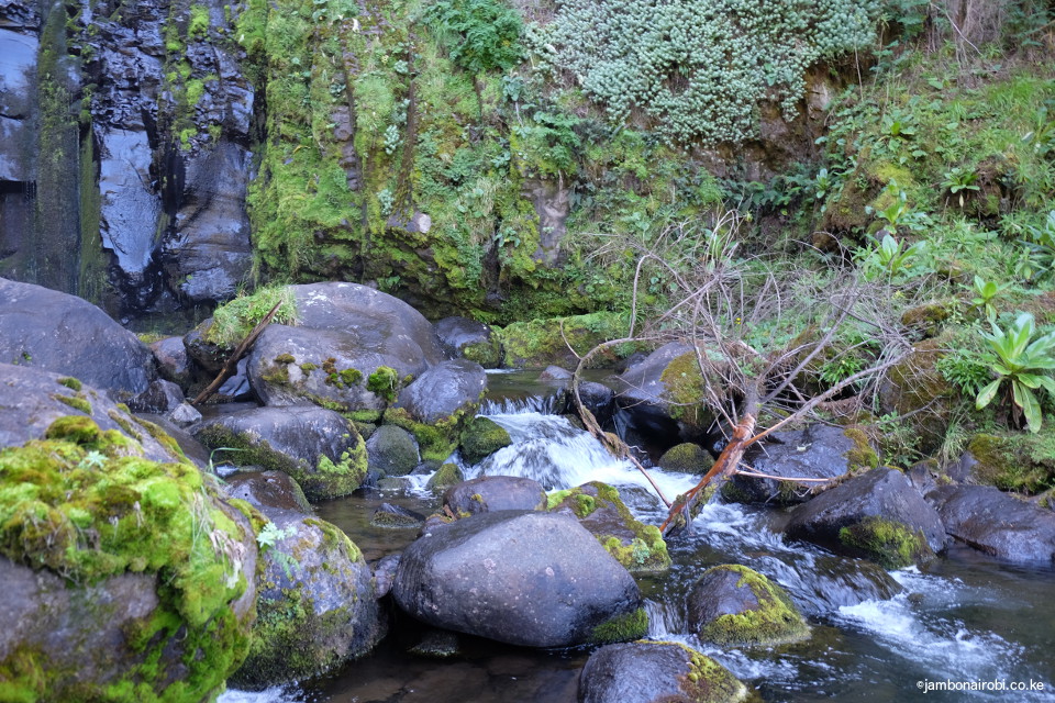
- Mountain stream, Mt Kenya
-
- Hall Tarns, Mt Kenya

-
- Near Mintos Hut, Mt Kenya

Route Description
You spend the first day either trekking, driving, or being driven from Chogoria town to the Chogoria Park Gate at 2950m asl. This 29km long journey goes over a motorable dirt road passing through fertile farmlands before getting into a tropical forest, followed by a bamboo zone. Most people choose to spend their first night at the Kenya Wildlife Service campsite at the Park Gate, or at Meru Mt Kenya Bandas a few hundred meters from the Park Gate.
The second day typically entails hiking 6km further up to the Roadhead at 3300m asl. Camping next to the Nithi River at this place helps with acclimatization. Since it only takes 2hrs to get here, that leaves you with plenty of time to explore the surroundings. One of the attractions here is the Nithi waterfalls, approximately 100ft high, accessible by crossing the river and following the trail to the left for about 300m. Other attraction are Lake Ellis at 3500m asl and about 3km to the right of the Roadhead, and Mugi Hill next to the Lake. If you climb to the top of Mugi Hill, you’ll get a bird’s eye view of the neighboring flat-topped Giant’s Billiard table.
The third day is spent hiking for about 4 to 6 hrs to Minto’s Hut at 4297m asl. Along the way, you get magnificent views of Lake Ellis to the right, the Gorges Valley to the left, and the 1500ft (457m) Vivienne waterfalls which appears at position 139 on the list of the World’s tallest Waterfalls. Even more striking is the view of Lake Michaelson at the top of this waterfalls, and the view of the distant peaks on a clear day.
Once you get to Minto’s hut, you have the option of using the hut or camping on the shores of the adjacent Hall Tarns. A short 5 minute walk to the side of these Tarns is a sheer cliff drop called The Temple, with a stunning view of Lake Michaelson directly below.
The forth day is when most people summit. The day starts at 3.30am with the aim of getting to Point Lenana at Sunrise. The terrain is a bit marshy in the first 2km, followed by a series of steep gravelly climbs. The first slope levels off at Simba Tarn, followed shortly by another steep incline that meets the trail from Shipton’s near Square Tarn. The trail then weaves its way above this Tarn till Pt Lenana, taking 3hrs or more from Minto’s Hut.
From this point, you have the option of descending through any of the three popular routes. If going through Naro Moru route, you’ll drop to Mackinder’s Camp and beyond. If going through Sirimon route, you’ll drop to Shipton’s Camp and beyond, while for Chogoria route, you’ll retrace your steps. It is possible to descent all the way to the Park Gates in one day on any of the three routes.
Safety